Tour of upper mustang

0
  • 7 Days
  • Max Guests : 26
  • Difficulty : 8/10
  • Solitude Lv : 8/10
  • Distance : 40 KM

Detail

Exploring the terrain of a land is best done on a motorcycle and Nepal is a country with innumerable types of terrain. Nepal is also where the ice – cold, mighty Himalayas meet the lush green tropical region of the Terai plains. For the past few years Nepal has become a popular destination for motorcyclist around the world as it offers views of the magnificent Himalayas, colorful and vibrant cultures, ancient temples and monasteries, jungle safari in search of the elusive tiger and more…

Activities

  • Fishing
  • Kayak
  • Campfire
  • Biking
  • Navigating
  • KayakShooting
  • Night Exploring
  • Photography

Price Includes

  • Air fares
  • 3 Nights Hotel Accomodation
  • On Trip Transport
  • 2 Meals / day

Price Excludes

  • Driver Service Fee
  • Guide Service Fee
  • Room Service Fees

What to Expect

When choosing a destination for your backpacking trip, it is important to consider the level of difficulty of the trail and the weather conditions. Some popular backpacking destinations include national parks, wilderness areas, and mountain ranges. It is also important to obtain any necessary permits and to be aware of any regulations or rules for the area you plan to visit.

  • View the Nature
  • Hiking in the forest
  • Discover the famous view point “The Lark”
  • Sunset on the cruise

Itinerary

Day 1: Arrive Kathmandu

Upon arrival transfer to the hotel. The day is free for you to explore and finish your last minute preparations for the big ride. Overnight at hotel.

Day 2: Kathmandu to Pokhara(827m/210kms/6hrs)

07:30AM met by the road captain and the rest of the team at the hotel lobby and ride to Pokhara. ​ We negotiate the traffic out of the Kathmandu city and ride out of the valley at the crosssection of the ring road at Kalanki and then set out for check post at Nagdhunga, just pastThankot. From here, the road twists and turns as we negotiate the traffic and descend toNaubise, 26 kilometer marker (about 17 kilometers from Nagdhunga).Upon arrival at Naubise we stop for a while at a local tea shop for tea. From here the road becomes much wider and smoother all the way to Kurintar, 103 kilometers from Kathmandu. Another two kilometers brings us to the Manakamana temple. We continue riding to Mugling, the junction where the highwaybifurcates, South to Chitwan and West to Pokhara.Lunch: Mungling/KurintarHead west for 90 kilometeres towards Pokhara by crossing the suspension bridge and following the Marshyangdi River for a while. Pass through typical Nepali landscape of scattered villages with ochre coloured thatched houses, rice fields, winding roads and groups of small settlements. Our arrival in Pokhara area is greeted with fantastic views of the western Himalayas, the Annapurna range and the famous Fish Tail Mountain. Pokhara stands at 884 m above sea level, about 700 m lower than Kathmandu Valley. In Kathmandu Valley the high temples are all around you, in Pokhara it is the mountains. Only foothills separate Pokhara form the full height of the Himalayas, and the magnificent 8000 m. peaks of the Annapurna range. Pokhara is a vacationer’s paradise with its crystal clear lakes and fantastic views of the Annapurna range including the Fish Tail Mountain.Evening: gather at the hotel lobby for a briefing by the Road Captain. Then later introduction with the rest of the backup and support team and the bikes followed by a short ride to get accustomed and also conduct necessary adjustments to the levers, brakes etc with the help of our mechanic and support team. Overnight at Pokhara

Day 3: Pokhara to Kalopani (2450m/130kms/5hrs)

Overnight at PokharaDay 02:Ride Pokhara to Kalopani (2450m/130kms/5hrs) After an early breakfast, leave Pokhara and ride towards Beni (approx. 70 Kilometers) on theBaglung Highway. This section of the ride provides fantastic mountain vistas, picturesque terraced farmlands and an opportunity to walk on one of Nepal’s famous suspension bridges.At Mal Dhunga, leave the main highway by taking the right trail and follow a dusty graveled path all the way to Beni, the district headquarters of Myagdi District in Dhaulagiri Zone. It is located on the confluence of Kali Ghandaki and Myagdi rivers at an altitude of 799 meters and is a bustling town lined with stores, restaurants, hotels and various government offices.From here, the road is unpaved and dusty with potholes in several places. Unpaved, graveled rough road poses a real challenge for riders and makes it more difficult with the occasional river crossings.Ascend gradually through the Kali Gandiki gorge, the deepest gorge in the world. There is a continuous change in the topography with every twist and turn until our arrival at Tatopani.From here set out on the trail by following the Kali Gandaki River and passing the Thakali and Magar Villages to Dana (4750 ft. / 1446 m.) famous for its beautiful cascading waterfall.Steeply ascend to Ghasa(6600 ft./ 2012m) and continue the ride on a dusty and one of the difficult section of the road towards Jomsom via the Thakali villages of Tukuche and Kalopani. Enroute, there are fantastic views of the Mt. Dhaulagiri (8167 m), Tukuche (6920m), and Nilgiri (7061m).As we pass between the Dhaulagiri and the Annapurna mountain range, a dramatic change in vegetation is witnessed from green forests, to dry arid desert. It takes gradual acclimatizing with the surrounding. The Thakali’s are the dominant tribe of the valley, related to the Gurung and Magars of the southern slopes. As soon as we pass Ghasa we will come to a place known as Dhaiku where we have to cross the bridge. After riding approximately for 10 kilometers via Lete we will come to our today’s destination Kalapani. Kalapani is scaled to be at 2530 meters. One can enjoy a very beautiful view of Mt. Nilgiri and Mt. Tukuche Upon Arrival at Kalopani check in to the lodge and rest of the evening is free to relax and explore around the Kalapani village.Overnight at Kalopani

Day 4: Kalopani to Muktinath via Jomsom (3710m/55kms/4hrs)

After an early breakfast, set out on the trail by following the Kali Gandaki River and passing the Thakali and Magar Villages to Marpha. On the way we will be passing through Kokhethanti village and Tukuche village to get to Marpha. Marpha is known to be the one of the oldest and most famous village.Marpha situated at an elevation of 2670 meters. Marpha is famous for its apple orchards and apple products. This large Thakali village exhibits the typical ThakKhola architecture of flat roofs and narrow paved alleys and passageways. It also has a monastery.After a short break at Marpha continue the ride towards Jomsomthrough the dusty graveled “off” road passing smaller settlements and apple orchards. There are excellent views of Mt. Nilgiri and the Kali Gandaki River flows on the right hand side of the trail.This day’s journey is a tough one but the scenic views of the rugged landscape, beautiful cascading waterfalls, orange and apple orchards, scattered roadside villages, ancient Buddhist monasteries all make it ‘One Hell of a Ride”.Jomsom(2713 m) is more correctly known as Dzongsam or New Fort. It spreads over both the banks of the Kali Ghandaki. The towering peaks of Dhaulagiri and Nilgiri form an attractive backdrop. Being the district headquarters, it is primarily an administrative and commercial center with government officials and merchants rubbing shoulders with the local inhabitants of the region, known as the Thakalis. Jomsom is the Administrative center of the Mustang region and the gateway to the Annapurna region. A land of mystique, the rugged peaks of the Annapurna, Nilgiri and Dhaulagari gaze down in their awesome splendor at weathered landscapes that contrast with the deep river ravines over noisy riverbeds. Jomsom is a mixture of hard work, social frivolity tempered by culture founded on deep religious traditions. It has the only airport that operates daily scheduled flights to Pokhara in the early mornings before the winds build up.From here continue ride passing through the village, past the High Altitude Mountain Warfare School of the Royal Nepal Army and through several restaurants, bhattis and a hospital. We pass through the old Jomsom village which boasts of several lodges, restaurants school and government offices. At the end of the village the valley opens wide, take the left side of the trail just after crossing the three ruined chortenand continue on the east bank of the Kali Ghandaki River. After about 20 minutes, arrive at Ekklaibhatti a small village with few lodges. There are two trails here. The left will lead to Kagbeni while the right one leads to Muktinath. We take the right trail and continue to ascend slowly to the settlement of Jharkot, which has a fort “Kot”.From here, another 15 minutes ride on the desert plateau brings us to Muktinath.Upon arrival at Muktinath check in to the guest house.Late PM: Visit Muktinath TempleThe Muktinath Templeis a sacred place both for Hindus and Buddhists and is located at an altitude of 3,710 meters at the foot of the Thorong La (5416 m Pass), Mustang district, Nepal. The site is close to the village of Ranipauwa, which sometimes mistakenly is called Muktinath as well.The Hindus call this sacred place MuktiKshetra, which literally means “Place of Salvation”. This temple is considered to be the 105thamong the available 108 DivyaDesam. The ancient name of this place, before the Buddhist origin was known as ThiruSaligramam.In Muktinath-Chumig Gyatsa all the elements are represented and for this and reasons unseen, yogis from both religions do their meditation at Muktinath.For Tibetan Buddhists, Muktinath (ChumigGyatsa) is a place of Dakinis (goddess known as Sky Dancers). It is of great importance for Buddhists as Chumig Gyatsa is one of the 24 Tantric placesFor Hindus, beside the natural fire representing Brahman and the holy waters, the central meaning of the Muktinath area is veneration of the god Vishnu in the form of ammonites (shilas) called Salagrama – Shilas.There are many stories which tell of Vishnu turning into stone and all of them are closely connected to the holy Kali Ghandaki River. According to contemporary geologists, the Salagrama – silas (found at the banks and river bed of the holy river Kali Ghandaki) are fossils of a prehistoric insect. This insect is mentioned in the BhavisyaPurana. Therein, Tulasi, the sacred plant so dear to Vishnu, cursed Vishnu to become a stone during one act of their eternal lila. Vishnu said, “To fulfill your curse, I will become a stone (Salagrama-sila) and will always live on the banks of the Ghandaki River. The millions of Vajrakita worms that live at that place will adorn those stones with the signs of my chakra by carving them with their sharp teeth”.After the sightseeing tour of Muktinath Temple descend down to the Ranipauwa (Main Bazaar of Muktinath).Rest of the day is free to relax or explore around the town.Overnight at Muktinath

Day 5: Muktinath to Gheling via Kagbeni(3520/45kms/3hrs)

After leisurely breakfast ride back down to Kagbeni (2800 m) which is the gateway to Upper Mustang. (Note: The Kaligandaki Valley becomes increasingly windy during the day as the winds blows south to north and makes it difficult for travelers.Kagbeni at an altitude of 2840m is a fascinating medieval village with closely packed mud brick houses, dark alleys and imposing chortens lies along the Around Annapurna Trekking route and is the gateway to Upper Mustang. The village stands in a little green oasis dominated by its red monastery. Though the village has a very medieval look, it can provide all the modern amenities that a traveler requires. This is the only village after Jomsom where there is an internet facility for communication with the outside world. This village also boasts of a Monastery. The monks here are of the yellow hat or the GelukpaSect and have only recently opened their monastery to visitors with a legitimate entrance fee of Rs 100, which they collect for the maintenance of their school.After completing the permits work we continue our ride to Geling. As we pass Kagbeni village we will be riding on the bank of Kali Gandaki River. Kali Meals (Black) and the water of the river are black in color. As we ride on we will come to the mall village settlement knows as Tangbe, which has couple of house and tea house for the trekkers and travelers. As we pass through the Tangbe village, after 20 to 25 minutes ride we will come to another human settlement known as Chele.At Chele there is a Steel foot bridge. This bridge is quite small one and it is normally used by the villagers and the trekkers. Upon arrival at the bridge we will have two options either ride on the bridge and cross the river or ride the bike under the bridge through the running river to cross the river. In Chele we will be able to see the river tunnels which also lead us to Gheling. After crossing the river ride till Samar.The road is up the east bank of the Kali Gandaki River that climbs over many ridges as it heads north. Depending upon the weather we will use a combination of high trails and the river bank routes. We use the combination of these trails as also because of the construction of the road to upper Mustang which is still in progress.From here during our ride we can see the Gompa Kang and some caves on the west bank of the river. Unlike most Gompas in Upper Mustang, Gompa Kang is of the Nyingmapa sect. Alongside the East bank is the village of Tangbe at an elevation of 2930 m. Here are the trios of black, white and red chortens that typify Upper Mustang. The Nilgiri peak which dominates the southern skyline at Kagbeni continues to loom massively at the foot of the valley with its white washed houses, fields of barley, buckwheat, and wheat and apple orchards. The Chhuksang village is reached.Upon arrival at Samar we rest for a while and take lunch.After lunch continue our ride to Geling.Upon arrival at Gheling check in to the lodge and rest of the evening is free to relax and explore around the village.Overnight at Gheling

Day 6: Gheling to Lo-Manthang(3700m/35kms/3hrs)

After breakfast met by the rest of the team and continue the ride to Lo-Manthang. After crossing Geling we continue our ride to Ghami.After crossing Ghami we ride to Lo-Manthang. As soon as we leave Ghami we have to take right to get to Tsarang. Upon arrival at Tsarang continue the adventure ride to Lo-Manthang via Big Chorten and Lo Dry La River.Lo-Manthang is a medieval walled city on the Tibetan Plateau north of the main Himalayas range. Lo-Manthang served as the capital of the ancient Kingdom of Mustang, which survives as the Kingdom of Lo or”Upper Mustang”. Lo Manthang was founded in 1380 by Ame Pal, who oversaw construction of the city wall and many of the still-standing structures in the early 15th century. The monarchy officially ceased to exist on October 7, 2008 by Nepali Government order. The last king (raja or gyelpo) is Jigme Dorje Palbar Bista (born c. 1933), in the direct line of the historic monarchy dating back 25 generations to 1380. The population includes ethnic Lhobas.Upon arrival at Lo-Manthang check in to the lodge and rest of the evening is free to relax and explore around the kingdom of Lo-Manthang.Overnight at Lo-Manthang

Day 7: Lo-Manthang

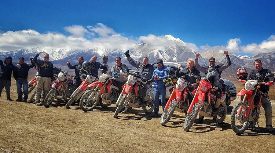
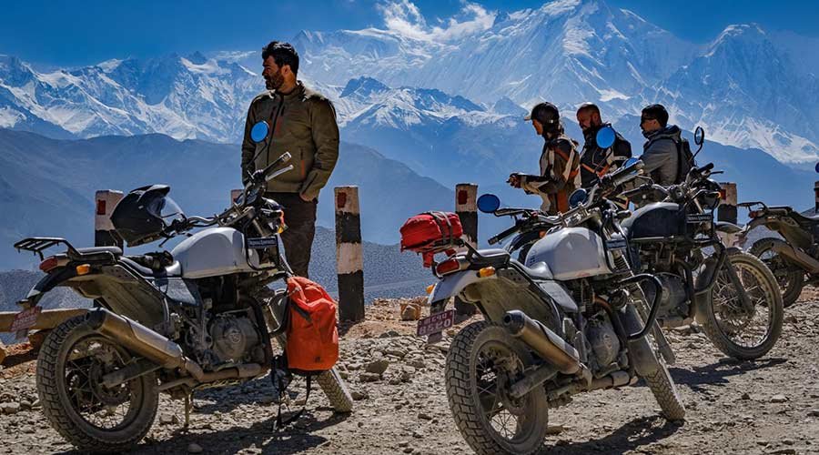
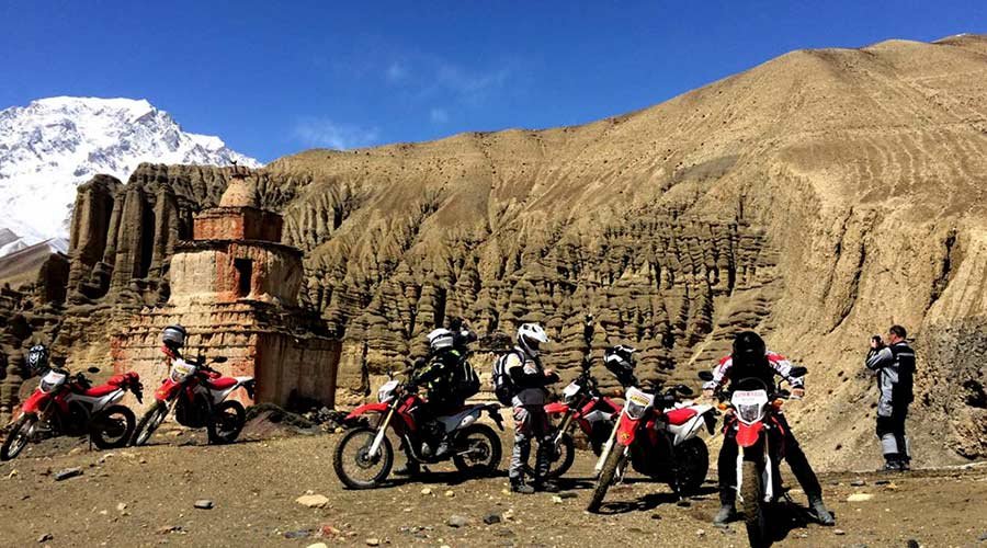
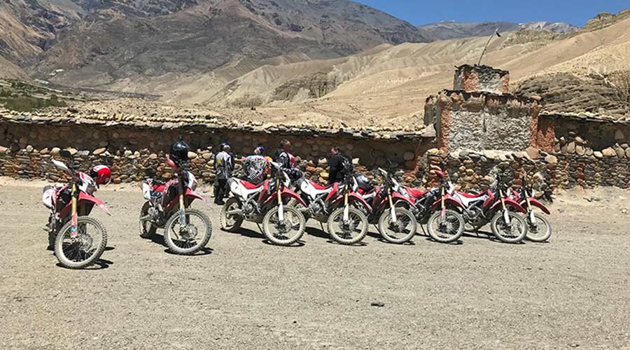
The major Temples inside the walls are ChampaLakhang (God House) which houses the massive 45 ft. statue of Maitreva, the future Buddha, The red ThugchenGompa with several large images of Sakyamuni, Avalokitesvara and Maitreya, and the ChyodiGompa of the Sakya sect which has several monks in residence and is the site of the annual Mani Rimdu festival in many which is referred as ‘tegi’ in Lomanthang. They are all supposed to have been built in 1420. Despite the apparent squalor of Lo Manthang, the city is prosperous and maintains a strong sense of community. Though the people call themselves Lobas- people from Lo, they are very much Tibetan and practice a sophisticated culture and economy.The King’s palace is an imposing 4 – storey building in the center of the city. It is the home of the present king – JigmeParbalBista. The Honorary title “Bist – a high caste title in Nepali” was conferred by the King of Nepal. Though his duties are largely ceremonial, he is respected by the people and consulted about many issues by villagers throughout Lo.​Ride from Lo-Manthang to neighboring village for the sightseeing tour. However, everyone is required to mount and dismount outside the city gates as only the King may ride a horse within the city walls.After a leisurely breakfast, we get ready for the days adventure. Today we are going to visit one of the most interesting sites of the pre human settlement in this unexplored valley. The most interesting thing will be we will be riding on a bike back to this beautiful site of Chhoser village. Since it is located near this village of Chhoser and so, famously known as the Caves of Chhoser. Beside these interesting caves it is also famous for the magnificent landscape and Nymphumonastery built on the cliffs. On our way back we can also visit the Namgyal village and monastery.The journey begins from the main walled city of Lo-Manthang and descends at the northeast end of the village to the river and then climbs to the other side of the valley. As you leave the walled city behind the landscape and vista slowly changes and become more beautiful and open in the aired high altitude desert. The journey on the motorcycle back will take you through the sparsely scattered settlement and agricultural farm lands and the never ending horizons of the rolling hills of the southern Tibetan plateau.As you approach the Chhoser village, you could see numerous caves in the front of the cliff that once use to be the home of the pre historic Loba’s and the monks. Cross the river and drive a little further towards the village where the horse / horseman will come to a stop. From here it’s time to walk towards the Cave, make sure you carry some money with you as they charge roughly about two hundred fifty Nepalese rupees. The Cave keeper, usually a monk, will come with the keys to assist the guest who have come to visit the caves. After the caves, we then visit the monastery nearby.After the sightseeing tour, we ride back to the city of Lo, on the way back we can also drive to the Namgyal village and monastery for the sightseeing and then finally back to the lodge form hot lunch.Rest of the day at leisure or free to explore the walled village.Overnight at Lo-Manthang

Day 8: Lo-Manthangto Kagbeni (2800m/75kms/4hrs)

After breakfast we ride back to Kagbeni following the same trail.We will stop for lunch at convenient place on the way.Kagbeni at an altitude of 2840 meters is a famous village of BaarahGaun (Lit: twelve villages) region in Mustang district that also lies in popular Annapurna Circuit Trek route and a gateway to Upper Mustang. It is a fascinating medieval village with closely packed mud brick houses, dark alleys and imposing chortens. The village stands in a little green oasis dominated by its red monastery. Though the village has a very medieval looks but has all the modern amenities that a travelers require. This is the only village after Jomsom where there is an internet facility for communication with the outside world. This village also boasts of a Monastery. The monks here are of the yellow hat or the Gelup Sect and are only recently opened to the visitors with a legitimate entrance fee of Rs 100, which they collect for the maintenance of school.Upon arrival at Kagbeni we check in to the lodge and rest of the evening is free to relax and explore around Kagbeni Village.Overnight at Kagbeni

Day 9: Kagbeni to Tatopani (1200m/61kms/4hrs)

After late breakfast visit the Kagbeni village and later continue ride to Jomsom. Jomsom is approximately 11 kilometers from Kagbeni. Upon arrival at Jomsom we complete the paper works and later continue further 25 kilometers, about 1 ½ hour slow ride to Kalopani via Marpha Village.Sightseeing tour of Marpha village.Marpha is at an elevation of 2670 meters. Marpha is famous for its apple orchards and apple products. This large Thakali village exhibits the typical ThakKhola architecture of flat roofs and narrow paved alleys and passageways. It also has a monastery. Marpha is a pretty stone lined village which has survived the transition to the current time, by catering to trekkers and tourists. Although it has an original Safe Water Drinking station, it now also sports numerous guest houses and small hotels. Dominating the village is the Nyingma monastery from which there are good views of the village and the Gandaki River valley. Above the monastery is a chorten painted onto the cliff face and a number of small stone chortens on the ledges below. Legend says that the villagers became afflicted with leprosy and all attempts to control it had failed. A local monk, originally from Tukuche, south of Marpha, advised the villagers to build the chorten and hold religious rituals at the site. Since that time the leprosy stopped and Marpha flourished once more After the sightseeing tours of Marpha take lunch at nearby restaurant or lodge.After lunch continue ride for another 25 Kilometer to Tatopani..Upon arrival at Tatopani check in to the guest houseRest of the day is free to relax or explore around the village.Overnight at Tatopani

Day 10: Tatopani to Pokhara (827m/105kms/6hrs)

It is a pleasant relief to be able to tackle the roughest section of the journey in the early morning. Descend to Beni (25 kilometers). After a quick stop for a quick, set out following the trail along the river and the after about an hour meet the main highway at Maldhunga and then continue of the metalled road to Pokhara which is reached in about 2 ½ hours.Upon arrival at Pokhara check in to the hotel rest of the day is free to relax or explore around the Lakeside Bazaar.Overnight at Pokhara

Day 11: Pokhara

After breakfast one is free to relax and walk around the lake side bazaar (Market) or one can enjoy the adventure activist in PokharaSuch as boating, paragliding, zip line, bungee etc. ​ Overnight at Pokhara

Day 12: Pokhara to Kathmandu (1370m/210kms/6hrs)

After breakfast met by the road captain at the hotel lobby and later ride back to Kathmandu.Lunch: Kurintar Upon arrival at Kathmandu check in to the hotel

Day 13: Kathmandu Depart

Post breakfast transfer to the airport to catch your flight back home.

FAQ

Can I get the refund?

We have you covered! We will email you as items in your order ship, or if there are updates on the status of your order. Can’t find the email?Click here to check the status of your order.

Can I change the travel date?

We have you covered! We will email you as items in your order ship, or if there are updates on the status of your order. Can’t find the email?Click here to check the status of your order.

My discount code is not working, what do I do?

We have you covered! We will email you as items in your order ship, or if there are updates on the status of your order. Can’t find the email?Click here to check the status of your order.

Do I need to apply visa?

We have you covered! We will email you as items in your order ship, or if there are updates on the status of your order. Can’t find the email?Click here to check the status of your order.

Do you have insurance covered?

We have you covered! We will email you as items in your order ship, or if there are updates on the status of your order. Can’t find the email?Click here to check the status of your order.

Wish List

Adding item to wishlist requires an account

Price

Tour Starts From

From₹5,100₹4,900
0
Full Name*
Email Address*
Your Enquiry*
* I agree with Terms of Service and Privacy Statement.
Please agree to all the terms and conditions before proceeding to the next step